BSRLC-U - The first tri-annual 10-m maps of urban Residential, Industrial and Open spaces for the Baltic Sea region over two decades (2000 – 2021)

This post summarises my presentation at the Living Planet Symposium 2025 (Vienna, 25 June 2025).
- 💾 Data repository: https://zenodo.org/records/14497660
Mapping high-resolution (10 m) urban areas over two decades with Landsat data—Is it possible?
- Landsat and Sentinel-2 are the principal sources of Earth-observation data for large-scale, long-term land-cover time-series analyses.
- The fine spatial resolution (10 m in the visible bands) of Sentinel-2 is particularly advantageous for distinguishing built-up classes such as residential buildings, industrial buildings, and artificial open spaces (e.g. roads, railways).
- Existing 10 m urban products—e.g. the Global Human Settlement Characteristics layer—depend on Sentinel-2 imagery and therefore cover only recent years.
- How can we obtain equally detailed maps for earlier periods, when only Landsat imagery was available?

Deep-learning super-resolution—Real-world deployment is harder than you think
- Deploying deep-learning single-image super-resolution (SR) on Landsat data is not a new idea.
- Most studies train SR models on temporally aligned Landsat/Sentinel-2 pairs and then apply the models to other Landsat scenes acquired under similar conditions.
- In practice, applying SR models to historical Landsat imagery is complicated by issues such as the Landsat-7 SLC-off gaps, inter-scene spectral inconsistencies, and cloud contamination.

If real images are problematic, can synthetic composites help?
- Spectral–temporal metrics (STMs)—statistics such as the minimum, maximum, median, or selected percentiles—aggregate information over time.
- STM composites are spatially consistent across scenes.
- In our recent study we showed that impervious surfaces exhibit resilience to temporal variability, an asset for long-term mapping.
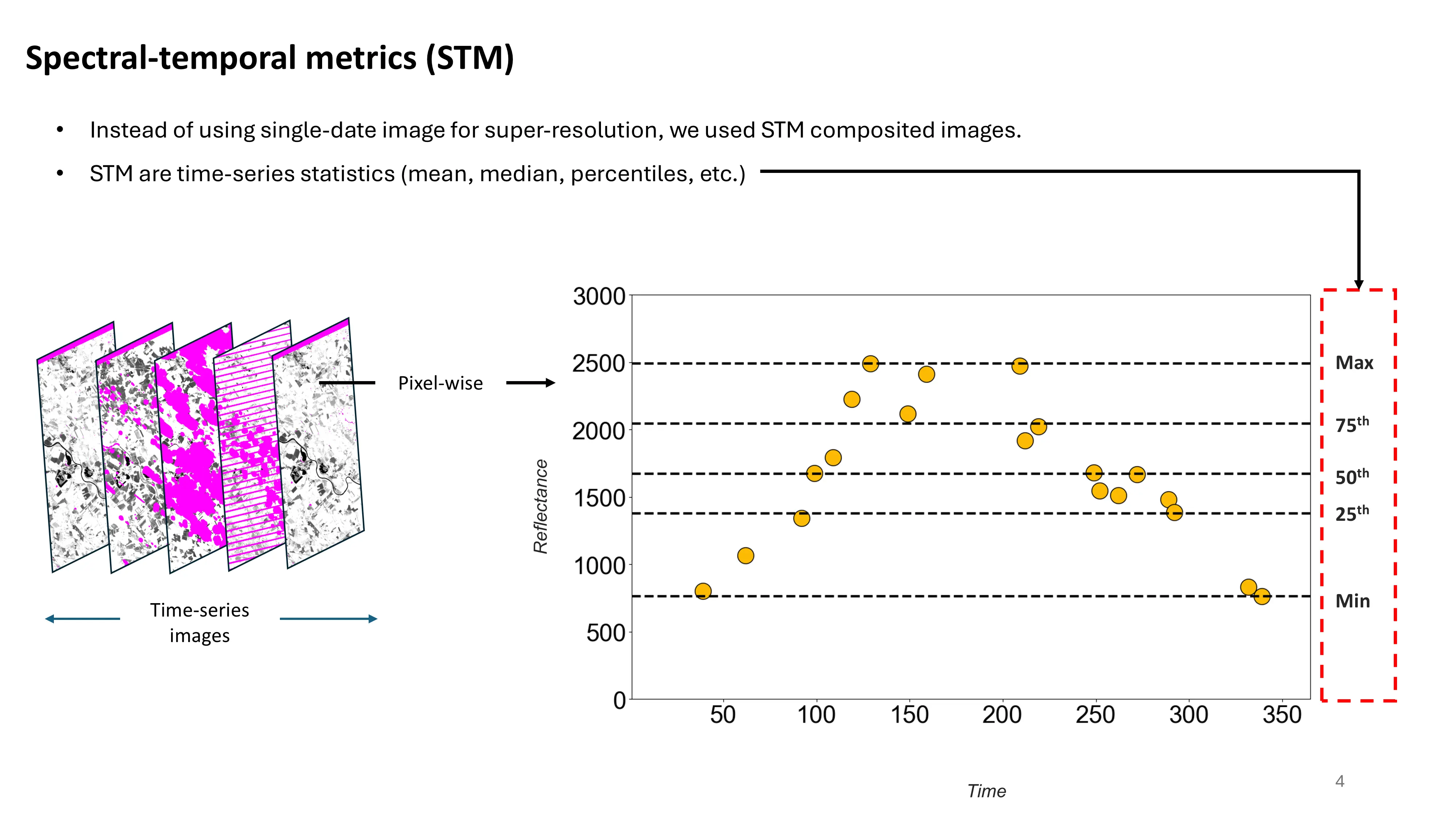
- By generating synthetic STM composites, we can harmonise Landsat and Sentinel-2 datasets in terms of both completeness and spectral characteristics.
- This harmonisation enables an SR workflow that is suitable for multi-decadal mapping.
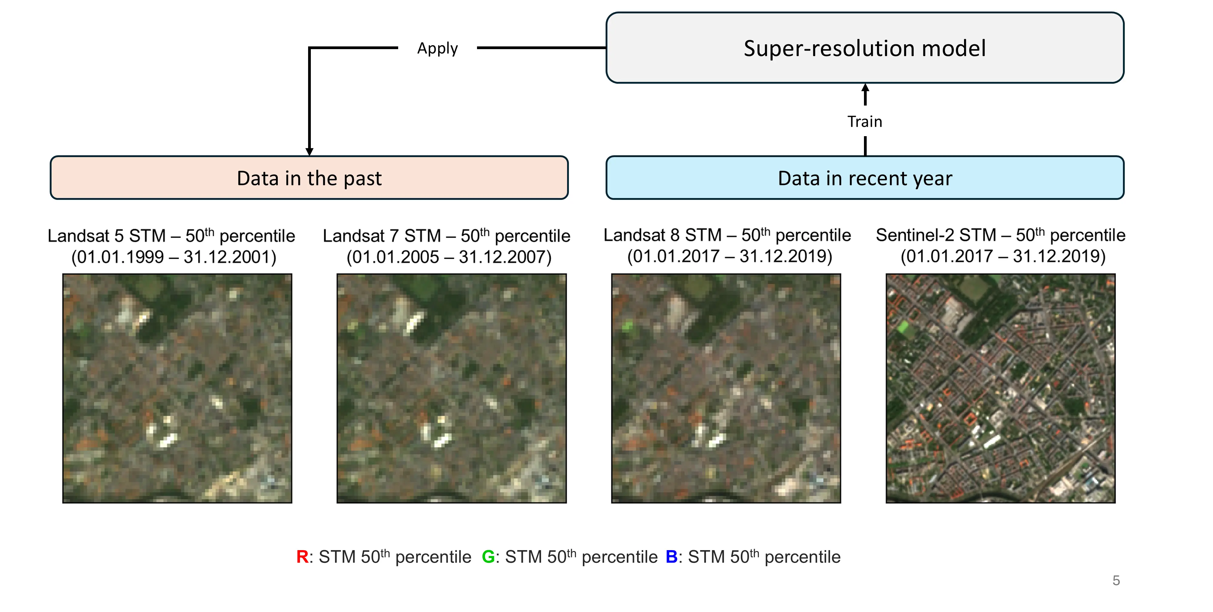
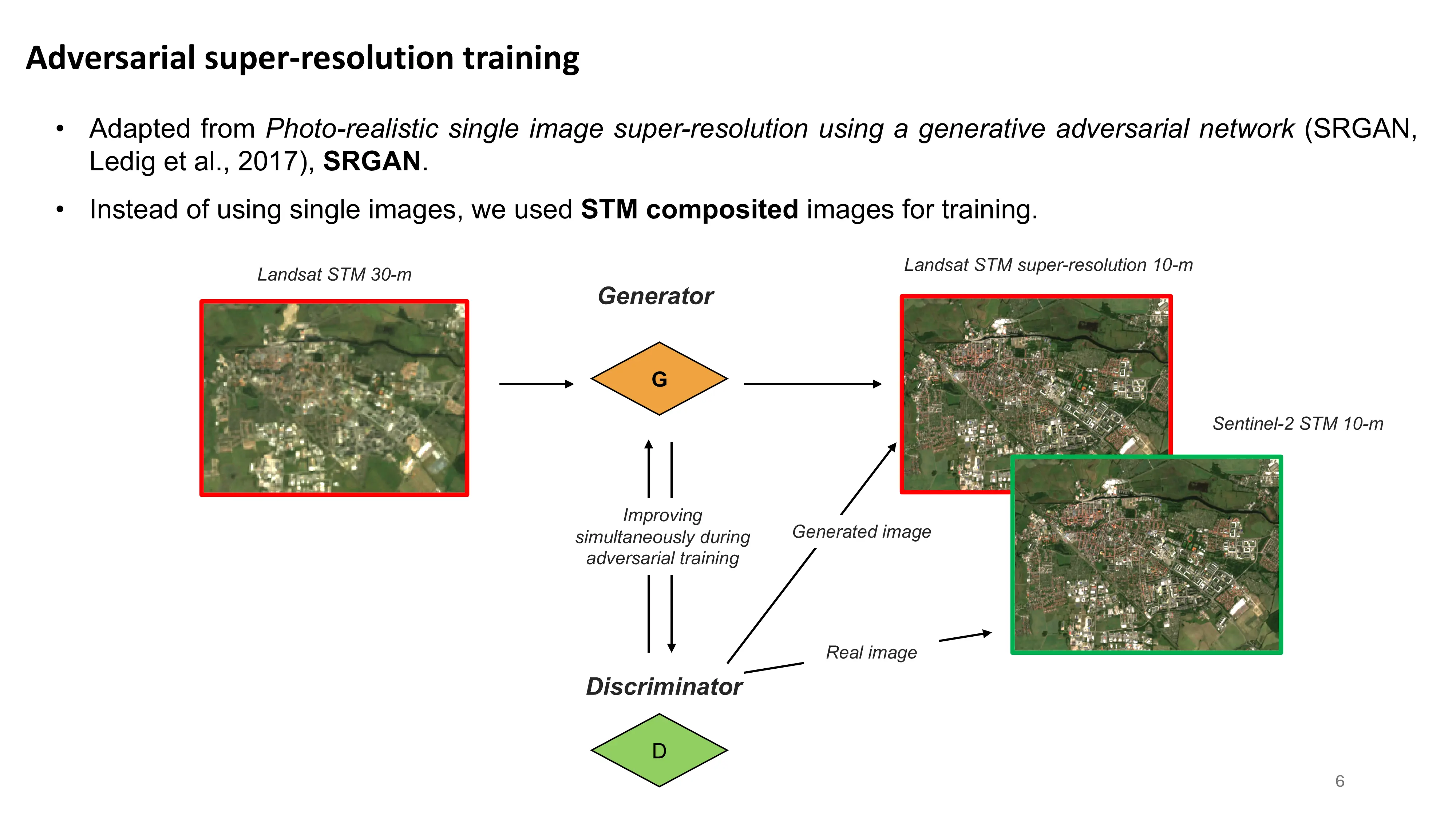
- We employ a single-image SRGAN architecture, training it on STM composites instead of raw imagery.
We have solved the resolution issue—Which classifier should we use?
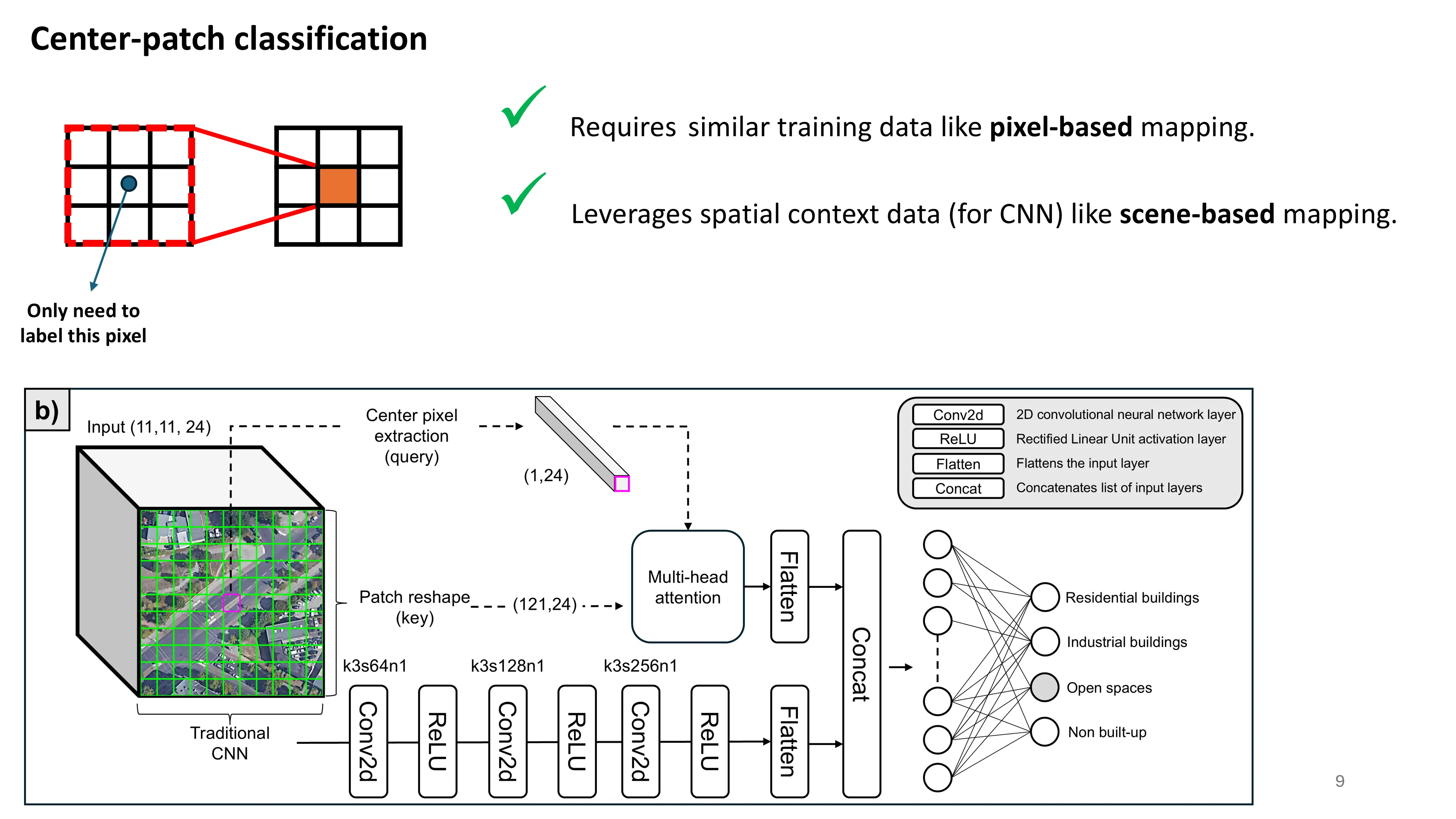
- Traditional pixel-based classification often struggles with urban scenes because different built-up types share similar spectral signatures at the pixel level.
- Patch-based approaches leverage convolutional neural networks (CNNs) and spatial context, but at the cost of reduced output resolution.
- Deep-learning semantic-segmentation models (e.g. U-Net) exploit spatial context while preserving resolution, but require exhaustive pixel-wise labelling—a labour-intensive task.

Centre-patch classification—Patch in, centre pixel out
- Have only pixel-level reference data but need CNN-level spatial context without sacrificing resolution? Centre-patch classification is the answer.
- It combines the strengths of pixel-based and patch-based approaches, functioning as a “lightweight” alternative to full semantic segmentation.
- Training is simple: provide a sufficient number of pixel samples, and the network learns to classify the centre pixel of each patch.
- We optionally add spatial-attention layers to guide the network, although they are unnecessary when ample training data are available.
Super-resolution results
- The examples below illustrate STM-based SR applied to Landsat imagery.
- In many urban areas, 30 m Landsat scenes are realistically up-scaled to 10 m.
- In the third panel, road surfaces—largely absent in native Landsat—are convincingly synthesised in the 10 m output.

- Subsequent classification with 10 m SR imagery outperforms the same workflow conducted on 30 m imagery (up-scaled by nearest neighbour).

Centre-patch classification performance
- The figure below compares our results with those of the GHSC product.
- GHSC: Sentinel-2 and OpenStreetMap inputs, pixel-based classification.
- Ours: Sentinel-2 or Landsat inputs, centre-patch classification.

The first large-scale, multi-temporal 10 m maps of built-up types in the Baltic Sea region
Data are available on Zenodo.

Berlin Brandenburg Airport construction (Berlin, Germany).

Urban development over two decades (Poznań, Poland).